Real-time Map of USGS River Gauges
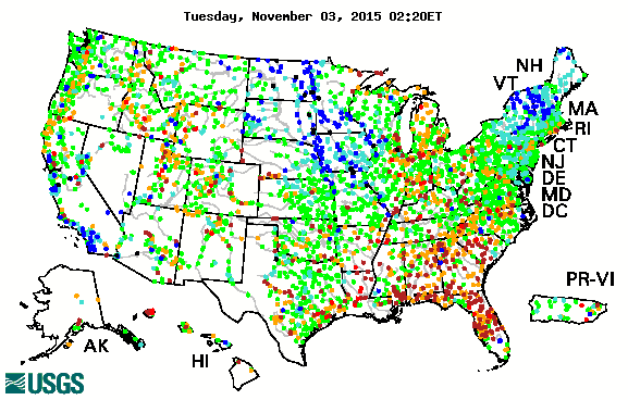 The USGS has added another excellent real-time mapping resource to their website. Areas in blue are wetter than at the same time last year, while drier areas are in red.
The map tracks short-term changes (over several hours) in rivers and streams. The general appearance of the map changes very little from one hour to the next, but individual sites may change rapidly in response to major rain events or to reservoir releases.
via USGS WaterWatch
posted by Dennis Ward on Monday, May 15, 2006
![]()


<< Home