Monday, June 26, 2006

NASA: Business as Usual

My friends and family know that I've been a huge supporter of manned spaceflight since watching the early Gemini launches as a child. I know that there is risk inherent in all spaceflight endeavors and that we as a race need to be willing to take risks.

However, it's my opinion that NASA Administrator Michael Griffin has made a grave decision that will needlessly place flight crews in harm's way. I'm not the only person who believes this-- please take a few moments to read this article from the Herald-Tribune: A Risk Not Worth Taking.

Does this sound familiar? It should-- it's the same business-as-usual crap that has killed three flight crews in the past. NASA ignored warnings about using pure oxygen at overpressure before the Apollo 1 fire. They ignored warnings about O-ring damage in cold weather launches prior to the Challenger explosion. They also ignored video footage showing insulation foam from the bipod mount falling away during launches prior to the Columbia disintegration. Three ignored warnings, three dead flight crews.

During Discovery's "Return to Flight" mission in 2005, a low-level sensor in the external propellant tank malfunctioned, scrubbing the launch. After much head scratching, NASA engineers decided that it was probably safe to launch with a faulty sensor. Launch they did, and although more foam broke off and slightly damaged the Orbiter, the sensors worked as designed. One might think, since the external tank was being redesigned anyway, that they might have addressed the low-level sensor problem, but you would be wrong-- they left the old problematic switches in place.

So here's the situation-- On July 1st, NASA plans to launch Discovery on another "Return to Flight" mission. The newly-redesigned external tank hasn't been flight-tested to determine if it's any safer than the old one, nor have they addressed the sensor issue. I think that AP's Mike Schneider summed it up nicely by referring to this flight as NASA's version of the movie "Groundhog Day."

If Griffin and the rest of NASA continues operating like this, sooner or later they are going to kill another crew.

Tuesday, June 20, 2006

Driving + Math = Fun

Ok-- I'm the first to admit that this post isn't about mapping per se, but I think this idea is quite clever and could be useful to math and geography educators.

Jamie Thingelstad has created a web site called Road Sign Math that challenges travellers to find mathematical relationships on highway signage, such as found on this one:

3 x 33 = 99

Users are encouraged to find their own local signs and add them to the database, which in turn adds them to a Google mash-up.

Not all mathematically significant road signs are created equal. Some signs are simply more interesting and exciting than others. Signs are scored in two categories, technical and elegance. High scores in either category are desired, and a total score is computed by adding the technical and elegance scores together.

Tuesday, June 13, 2006

Google Earth 4 Beta Released

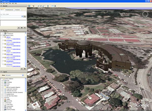
The good folks at Google have announced new versions of Google Earth and Google SketchUp. Google Earth 4 is available as a public beta, and is a Universal Binary application, bringing mac support to the mapping application for the first time. It features a new streamlined interface, support for objects built in SketchUp, and vastly improved satellite imagery coverage, which reportedly now covers approximately 25% of the Earth's surface.

The Google Earth 4 beta is available for download at http://earth.google.com/download-earth.html

Google SketchUp 5 adds support for textures, allowing you to apply photographs or other images to a building object to add more realism to your Google Earth 3D models. Google SketchUp is free and available for download at the Google Web site.

Google SketchUp 5 is available for download at http://sketchup.google.com/download.html

Monday, June 12, 2006

Gapminder World 2006

Gapminder is a non-profit venture that develops information technology for provision of free statistics in new visual and animated ways. In short, it enables you to make sense of the world by having fun with statistics. Their method is to turn boring data into enjoyable interactive animations using Flash technology.

The statistics on their site can be viewed in either interactive charts or maps. This is one of the most innovative statistical dataviewers I've come across and is certainly an impressive demonstration of the power of Flash.

Gapminder is a Foundation in Stockholm, Sweden. Funding has been mainly by grants from Swedish International Development co-operation Agency, Sida. In collaboration with United Nations Statistic Division they promote free access to searchable public data and their animations of different types of data are freely available at http://www.gapminder.org

via Gapminder site

Map Pros: Careers in Geospatial Technologies

The following site has just gone live:

http://www.geospatialcareers.net

The site is for students and others interested in learning about careers in geospatial technologies. It features career information and profiles of people who use geospatial technologies.

Since people with skills in geospatial technologies are needed in a wide variety of fields, the site was developed to encourage and assist those interested in exploring career options.

It is sponsored by the NH Space Grant Consortium in partnership with NH GRANIT and the University of New Hampshire Cooperative Extension. They've done a wonderful job with it and it will be an excellent addition to career presentations, GIS-based workshops, and more.

via Joseph Kerski, USGS

Tuesday, June 06, 2006

Remote Sensing & Human Rights

Satellite images captured under a pioneering program of the American Association for the Advancement of Science (AAAS) provide powerful evidence that the government of Zimbabwe has destroyed an entire settlement and relocated thousands of residents as part of a campaign against political opponents.

The images, analyzed by the AAAS staff, show two views of the settlement of Porta Farm, located just west of the Zimbabwean capital of Harare. The first, an archived image from June 2002, shows an intact settlement with more than 850 homes and other buildings; an estimated 6,000 to 10,000 people lived in Porta Farm at the time. The second photo, taken by satellite on 6 April 2006, shows that the settlement has been leveled.

The pictures were released on 31 May as central evidence in a report compiled by the international secretariat of Amnesty International in London and Zimbabwe Lawyers for Human Rights (ZLHR), based in Harare. The report, “Shattered Lives: The Case of Porta Farm,” views the destruction of the settlement and the forced relocation of its residents as emblematic of a broad campaign by the government of President Robert Mugabe to repress political opposition.

The photos of Porta Farm were collected under a new AAAS program that is exploring how satellite imagery and other cutting-edge geospatial technologies can be used to assess potential human rights violations and prevent new ones before they develop.


"We believe this technology will become a critical tool for human rights organizations worldwide," said Alan I. Leshner, chief executive officer of AAAS and executive publisher of the journal Science. "By using new technology to systematically analyze satellite images and geospatial data, AAAS researchers were able to help Amnesty International and Zimbabwe Lawyers for Human Rights document the destruction of Porta Farm. The satellite images show the technology has enormous potential for helping to prove broad human rights violations. And perhaps someday in the future the technology will make it possible to intervene earlier in a human rights crisis, before it’s too late."
All Images (C)COPYRIGHT 2006 DigitalGlobe Inc. ALL RIGHTS RESERVED

via Kristian Gleditsch, University of Essex

Monday, June 05, 2006

Skip to m'Loo Down Under

OK, It's now official-- I have seen everything...

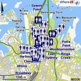
The Aussie government has published the National Public Toilet Map online, driven by the WhereIs mapping engine.

The map shows the location of more than 14,000 public toilet facilities across Australia. Details of toilet facilities can also be found along major travel routes and for shorter journeys as well. Useful information is provided about each toilet, such as location, opening hours, availability of baby change rooms, accessibility for people with disabilities and the details of other nearby toilets.

In what has to be the most bizarre usage of the .GPX geocaching file fomat to date, the site's FAQ page contains this entry:
Adding a toilet to your GPS device
On the toilet details page, the approximate latitude and longitude of the toilet is displayed underneath the address. Make sure your GPS device is set to display decimal degrees and is set to use the WGS 84 (World) or GDA 94 (Australia) datum. You can then enter these decimal numbers into your GPS and save them as a waypoint (some GPS devices may allow you to choose a toilet icon). Once you have selected your favourite areas, simply click on the "Download your favourite toilets and areas in GPX format" link in your "My Toilet Map" section. The file will be in ".gpx" format and should easily integrate with your GPS device software.
via The Australian Gov't Dept of Health and Aging

Thursday, June 01, 2006

From Squaw Tit to Whorehouse Meadow

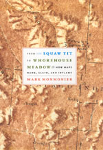
In case you haven't heard, Mark Monmonier has a new book out: From Squaw Tit to Whorehouse Meadow: How Maps Name, Claim, and Inflame. The University of Chicago Press website has published an excerpt from the section on Body Parts and Risqué Toponyms.

Here's a blurb from another well-know geographer...

“Mark Monmonier has done it again! By combining meticulous research with crystal-clear exposition, America's foremost geographic interpreter takes us on a riveting excursion across maps displaying legacies of racism, sexism, colonialism, imperialism, and other cultural and political offenses. In this brilliant and readable exposition, Monmonier ranges from hilltops in Arizona to orchards in Israel, proving forcefully that maps have consequences. This is an entertaining and indispensable resource for anyone who has wondered how certain names got on the map and why some of them are still there.”
—Harm de Blij, author of Why Geography Matters

via the University of Chicago Press

Two Die in GPS Treasure Hunt

Two GPS treasure hunters were killed over the Memorial Day weekend when their four-wheel-drive vehicle struck the side of a canyon wall near Onyx, CA and then drove over the edge of a 900-foot granite-ribbed cliff.

The two men were participating in a cross-country treasure hunt, believed to have originated in San Bernardino County, using global positioning system coordinates, according to the CHP. Typically in such competitions, participants locate a hidden marker, then move on to the next waypoint on the list.

Based on debris and skid marks at the scene, investigators believe the men struck the side of the canyon wall and then veered back across the road and over the side of the west embankment. The cliff is lined with granite boulders and the Jeep was crushed as it tumbled 900 feet to the bottom.

Contrary to early accounts, there is no evidence that the men were distracted by the GPS unit.

via the Bakersfield Californian

China To Map Uninhabited Lands

China has started mapping its largest area of uninhabited land to provide a detailed topography of Hoh Xil, a natural habitat for Tibetan antelopes and wild horses at least 4,000 meters above sea level.

The State Bureau of Surveying and Mapping launched a project last month to map this 2-million-sq-km area, which makes up at least 20 percent of the Chinese territory.

A team of 13 experts have arrived in Hoh Xil this week for an intensive survey of the land. They are expected to complete a high-precision map at 1:50,000 before the end of 2010. The map will facilitate scientific research, energy exploitation and wildlife protection in the 83,000-sq-km area.

The mapping of Hoh Xil constitutes part of the country's effort to map the vast 'blind area' in its west, an area covering deserts in southern Xinjiang, the Qinghai-Tibet Plateau and the Hengduan Ranges that run from the western Sichuan and Yunnan provinces to eastern Tibet.

In Qinghai Province alone, about 250,000 sq km of land has not been mapped at 1:50,000, mostly in Hoh Xil, the Tanggula Mountain and lakes and swamps in the plateau, where cold, arid weather, thin air and little access for traffic make mapping extremely difficult.

via People's Daily Online